Where Are The Kamo River Stepping Stones At The Demachiyanagi Delta?
The stepping stones sit at the Demachiyanagi delta in northern Kyoto, at the meeting of the Kamo and Takano rivers, a short walk north of the downtown riverbank crowds.
Short answer
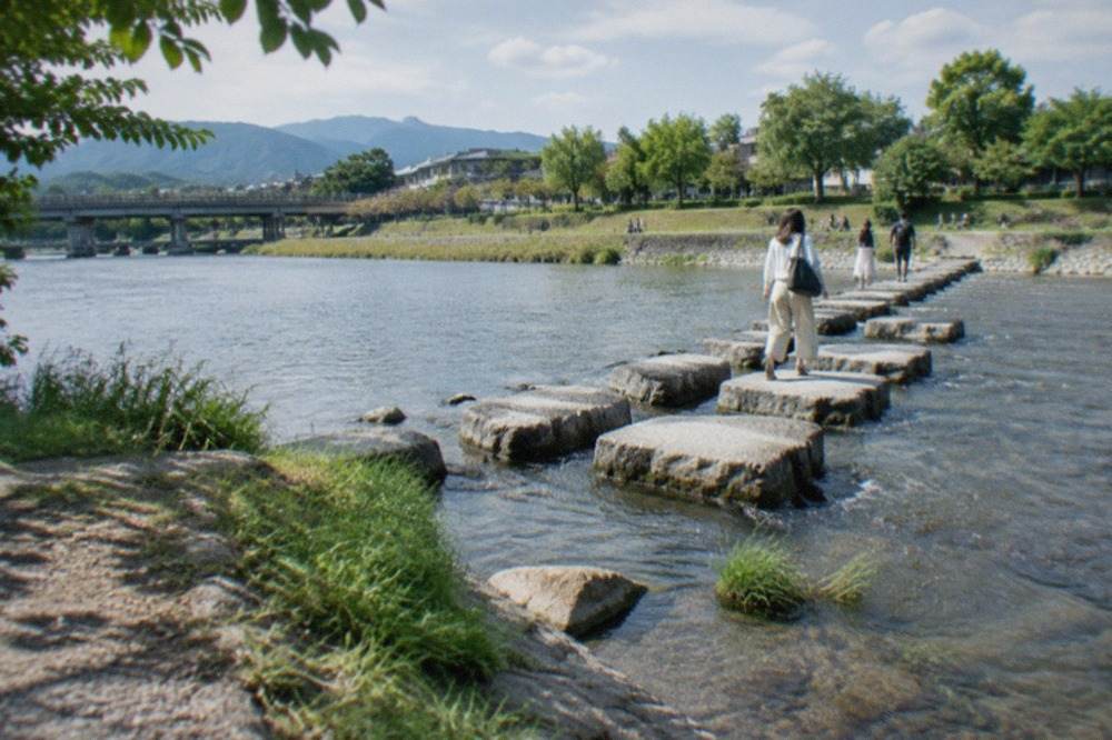
The Kamo River stepping stones are at the Demachiyanagi delta in north Kyoto, where the Takano River joins the Kamo. The nearest station is Demachiyanagi on the Keihan and Eizan lines, and the crossing is free, open at all hours and passable in normal conditions.
The Kamo River cuts Kyoto in two from north to south, and for most of its course through the city it behaves like one long public park: no gate, no ticket, no closing time. The riverbank paths carry joggers, herons, cyclists and, on summer evenings, rows of people sitting on the concrete steps below street level with drinks from the corner shops. The city's 2025 tourism survey, released in June 2026, counted a record 62.79 million visitors to Kyoto across the year, and a large share of them end up on this riverbank sooner or later, because it links almost every district a visitor wants to see.
At the top of that river sits the feature this page exists to explain: the Demachiyanagi delta, a wedge of ground where the Takano River flows into the Kamo, and where a line of stepping stones crosses the shallow water. It is one of the most photographed small crossings in the city, and one of the easiest to miss if you start your walk downtown and never go north. This guide covers where the stones are, how the delta works, what the river looks like month by month, and how to build a day around it.
Where Are The Kamo River Stepping Stones At The Demachiyanagi Delta?
The stepping stones sit at the Demachiyanagi delta in northern Kyoto, at the point where the Takano River joins the Kamo River just below Demachiyanagi Station. The nearest station is Demachiyanagi itself, served by the Keihan main line and the Eizan line, roughly two kilometres north of the downtown Shijo bridge. The crossing is free, has no posted hours, and is open to anyone willing to balance across in normal water conditions.
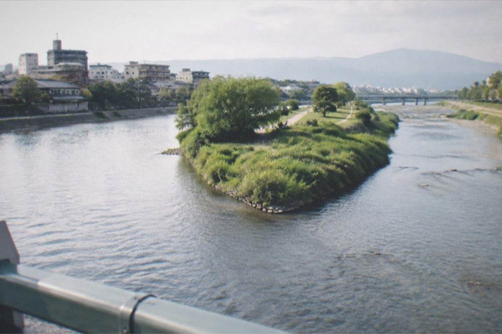
The delta is a triangle of parkland and gravel bars pinched between the two rivers, and the stones run across the Kamo's shallow channel on the downstream side of the junction. The crossing is a piece of practical infrastructure, not a monument: it exists so people on the west bank can reach the delta and the far side without walking down to a bridge, and it is built from large fixed stones set at a spacing that asks for attention rather than a stroll. Some of the stones are cut into playful shapes, including the turtle-shaped stones that give the crossing its character, and the whole set sits low enough that the river regularly flows over and around it.
Two things follow from that. First, the crossing closes itself in high water: after heavy rain or during the typhoon season the stones go under, and nobody should attempt them when the current is visibly moving fast or the stones are submerged. Second, the delta is at its best in the morning and early evening, when the light comes down the valley and the crowds are thin. The city's tourism association runs a crowd-comfort forecast that rates spots and time slots on a five-level scale using location data and weather, and the riverbank north of downtown consistently reads quieter than the Shijo and Pontocho stretches in the middle of the day.
Getting there is simple. From Kyoto Station, the subway's Karasuma line runs to Kitaoji or Kitayama with a short walk or bus connection to the delta; the flat city bus fare is 230 yen for adults and 120 yen for children aged 6 to 11, and the subway runs 220 to 360 yen by zone. If you are already downtown on Shijo-dori, the Keihan line from Gion-Shijo to Demachiyanagi is a few minutes and drops you almost on top of the stones.
How Do You Walk From The Demachiyanagi Delta Into Downtown Kyoto?
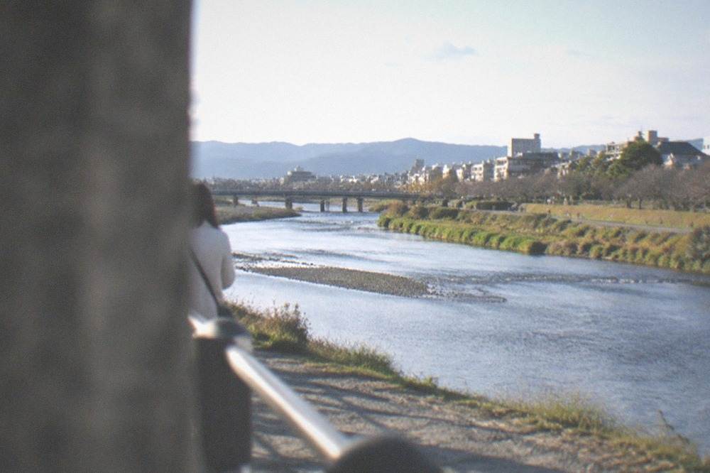
The standard walk follows the west or east riverbank south from the delta to the Shijo bridge area, a distance of roughly two kilometres that takes 30 to 45 minutes at a steady pace. The path is paved, level and continuous, passing under the Sanjo, Oike and Nijo bridges before reaching the Pontocho dining alley and the Gion side. Allow two hours if you plan to stop at Shimogamo Shrine, the riverbank parks and the bridges.
The walk works in either direction, but south to north has a logic to it: you start in the busiest stretch and the city thins out as you go, ending at the quietest and prettiest end. Going north to south, you cross the stepping stones first, work down through the delta, and arrive downtown with the whole river behind you.
Along the way the riverbank passes several things worth a stop. Near the delta, the Shimogamo Shrine precinct sits inside the Tadasu no Mori, a preserved woodland that is one of the few old-growth stands left in the city centre. Further down, the riverbank steps opposite Pontocho fill up on summer evenings, and the Pontocho alley itself runs one block back from the west bank, a narrow lane of restaurants and bars between Sanjo and Shijo. On the east bank, the Gion district begins a few blocks inland, and the philosophers path canal route to Ginkaku-ji starts from the river's upper stretches near the delta end of the city.
For visitors who would rather have a guide than a map, a walking tour of the Gion district covers the ground at the river's southern end with a local guide explaining the geisha districts, the teahouse culture and the rules that now govern the private alleys. The operator's listing gives the meeting point, the duration and the current price.
What Can You See Along The Kamo River In Kyoto?
The riverbank links, from north to south, the Demachiyanagi delta and its stepping stones, the Shimogamo Shrine woodland, the Kyoto Imperial Palace park a few blocks west, the downtown bridges at Sanjo and Shijo, the Pontocho alley, the Gion and Yasaka Shrine area on the east bank, and the Gozan no Okuribi mountain bonfires visible from the riverbed every 16 August. Almost all of it is free to walk.
That list is the reason the river is more than scenery. It is a spine. A visitor staying anywhere near the centre can reach the Kyoto Imperial Palace grounds, the Nanzen-ji temple district and the Kiyomizu-dera hillside, each of them a fixed walk from a riverbank point, without ever needing a bus. The palace is open to all visitors with no advance application, per the Imperial Household Agency's own visitor pages, and the agency's Kyoto office confirms the grounds carry no admission charge.
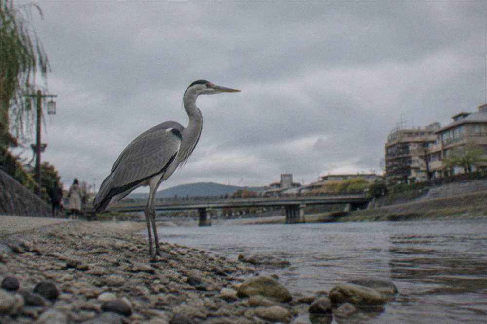
The birdlife deserves a mention, because it surprises people. Herons and egrets work the shallows year-round, and the gravel bars at the delta host ducks and, in the right season, migrating waders. The river is shallow and slow through the city stretch, which is exactly why the stepping stones work at all: this is not a whitewater reach but a broad gravel-bedded stream that floods fast in heavy rain and drops again within a day.
Below the downtown bridges, the river continues south past the Kyoto Railway Museum area and out toward Fushimi, where the Fushimi Inari shrine sits on its mountain to the east and the sake district along the canal. The shrine charges no admission and sets no closing time for its mountain paths, its own FAQ page states, and it counts about 10,000 torii of all sizes across the whole mountain rather than the single tunnel figure most guides repeat.
When Is The Best Time Of Year To Walk The Kamo River In Kyoto?
The most comfortable months for the river walk are late March to early May and October to November, when the JMA 1991-2020 normals put the mean temperature between 8.8 and 19.5 C and 12.5 and 18.4 C respectively. Cherry flowering in 2026 was recorded on 23 March with full bloom on 30 March, and the maple red-leaf normal is 5 December, so spring colour arrives weeks before the autumn colour does.
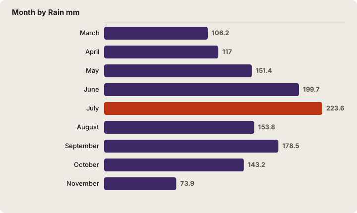
The seasonal argument is really a temperature and rain argument, and the Japan Meteorological Agency's Kyoto station, number 47759, has the numbers. The table below is the 1991-2020 normal for the station, the same series the site uses throughout its Kyoto weather coverage.
| Month | Rain mm | Mean C | Mean daily max C | Mean daily min C | Sunshine h |
|---|---|---|---|---|---|
| March | 106.2 | 8.8 | 14.1 | 4.3 | 155.4 |
| April | 117.0 | 14.4 | 20.1 | 9.2 | 177.3 |
| May | 151.4 | 19.5 | 25.1 | 14.5 | 182.4 |
| June | 199.7 | 23.3 | 28.1 | 19.2 | 133.1 |
| July | 223.6 | 27.3 | 32.0 | 23.6 | 142.7 |
| August | 153.8 | 28.5 | 33.7 | 24.7 | 182.7 |
| September | 178.5 | 24.4 | 29.2 | 20.7 | 142.7 |
| October | 143.2 | 18.4 | 23.4 | 14.4 | 156.0 |
| November | 73.9 | 12.5 | 17.3 | 8.4 | 140.7 |
Two readings of that table matter for the river. July, not June, is Kyoto's wettest month, 223.6 mm against 199.7 mm, which runs against the "rainy season ends in June" assumption most visitors carry. And August is both the hottest and the sunniest month, with a mean daily maximum of 33.7 C, which makes the riverbank steps the single most sensible place in the city to spend an August evening. Three of Kyoto's six hottest days on record, per the agency's ranking table for the station, fell in the summers of 2024, 2025 and 2026, so recent heat has been genuinely unusual rather than a normal Kyoto August.
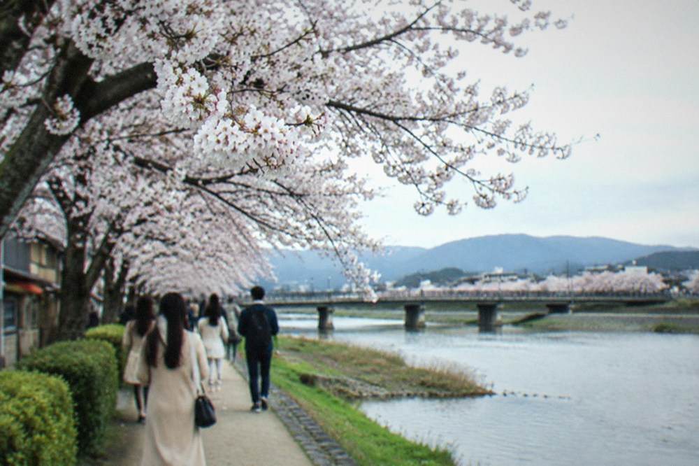
The cherry season along the banks is the busiest stretch of the year for the river. The agency recorded 2026 flowering on 23 March against a normal of 26 March, and full bloom on 30 March against a normal of 4 April, so the 2026 season ran early. The riverbank between the delta and Maruyama Park, which sits beside Yasaka shrine on the east bank, is one of the city's main hanami grounds, and the Maruyama park trees are floodlit in the evenings during the bloom.
Why Do The Demachiyanagi Stepping Stones Survive Floods?
The stones are set as individual fixed piers rather than a continuous bridge deck, so floodwater flows between them instead of pushing against a flat surface, and the gaps let gravel and debris pass through. The crossing is deliberately low, sitting close to the normal water level, which means it is designed to go underwater safely during high water rather than to stay dry at all costs. When the river drops, the stones reappear ready to use.
That engineering logic is why the crossing has lasted through typhoon seasons that move tonnes of gravel down the Takano and Kamo channels every year. A solid low bridge would trap debris and act as a dam; a raised footbridge would block the flood channel. Discrete stones with gaps do neither. The trade-off is that the crossing is genuinely impassable after heavy rain, sometimes for a day or more, and the water can be knee-deep over the stones even when the rest of the riverbank looks calm.
Practical rules follow. Check the water level before committing: if any stone is submerged or the current is visibly pulling across the line, walk down to the nearest road bridge instead, because there is always one within a few hundred metres. Wear something with grip, since the stone tops stay slick. And keep small children by the hand, because the spacing is sized for adult strides. The delta itself, the gravel bars and the park benches around it, remains usable in almost any conditions short of a flood warning.
The delta is also where the river's two names collide. The Takano comes down from the Kurama and Ohara hills in the north-east, and the Kamo drains the range to the west of it. Below the junction the combined flow carries the Kamo name all the way through the city. That geography is why the delta exists at all: two gravel-bedded mountain rivers meeting on a flat valley floor will always build a wedge of deposited sediment at the junction, and the park you stand on is that wedge, stabilised and planted.
What Festivals Happen Along The Kamo River In Kyoto?
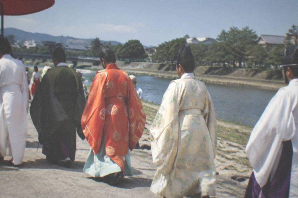
The river anchors three of Kyoto's four great calendar events: the Aoi Matsuri on 15 May, when the imperial procession rides between the Kamigamo and Shimogamo shrines on the river's upper reaches; the Gion Matsuri across July, whose floats are built and displayed in the streets just off the river's middle stretch; and the Gozan no Okuribi on 16 August, when five mountain bonfires are lit above the city and the riverbank is one of the main viewing points.
The dates are fixed by the shrines and the city, and the site's own festival pages carry the detail. The essentials:
| Festival | Date | River connection |
|---|---|---|
| Aoi Matsuri | 15 May annually | Procession between Kamigamo and Shimogamo shrines, both on the Kamo's upper city reaches |
| Gion Matsuri | 1 to 31 July | Yamaboko Junko parades on 17 and 24 July; float streets sit blocks off the river |
| Gozan no Okuribi | 16 August | Five mountain fires lit above the city; the riverbed is a principal free viewing area |
The Aoi Matsuri is the one that belongs to the river most directly. Its two shrine termini, Kamigamo and Shimogamo, both stand on the Kamo system, and the shrine's own pages confirm the 15 May date, with a postponement to 16 May if rain falls on the scheduled day. The Gozan no Okuribi, confirmed by the city's tourism association for 16 August, is best watched from open ground with a sightline north, and the riverbank north of downtown is a classic choice, though the association notes that entering the hills themselves is prohibited that day.
Gion Matsuri is less about the water than the streets beside it, but the geography matters: the float routes and the yoiyama evening streets sit within a few blocks of the river's middle stretch, and in July the riverbank steps function as the festival's breathing space, the place people escape to between processions. The shrine's own event page sets the parade dates at 17 and 24 July.
Is The Kamo Riverbank In Kyoto Safe And Free To Walk At Night?
Yes, in the ordinary sense: the riverbank paths are public, lit at the bridge crossings and busy until late, and the downtown stretches between Sanjo and Shijo carry foot traffic well past midnight in the warmer months. The city's tourism association publishes conduct guidance rather than safety warnings for the area, and the main real hazards are the unlit path sections between bridges and the water itself after rain.
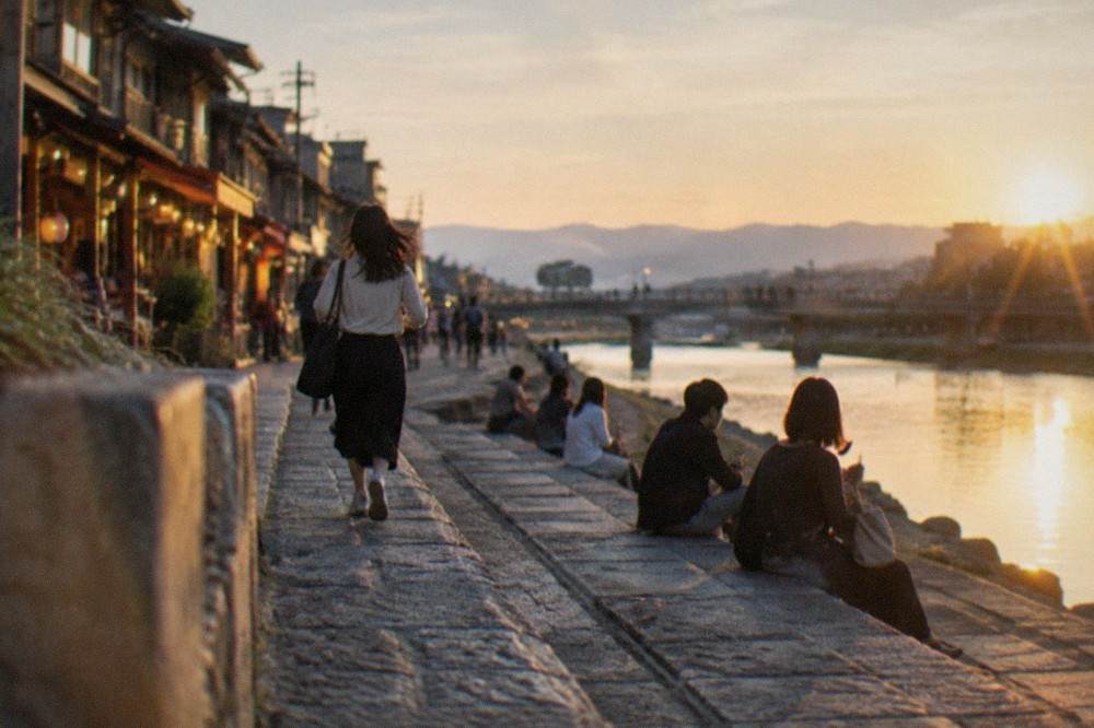
The summer evening culture on the banks is one of the city's genuinely free pleasures. From roughly June through September, the stepped concrete banks below street level fill with groups sitting on the ground with convenience-store drinks, a custom the city tolerates and the local press has covered for decades. The Pontocho side is the busiest, and the noise carries. Further north, around the delta, the evenings are quiet enough that the frogs are the loudest thing.
Two cautions are worth stating plainly. The path between bridges is not uniformly lit, so a torch or a phone light helps on the northern stretches. And the bank steps drop about two metres from street level to the water, which is fine in daylight and demands basic care after dark or after drinking. The river current in the city stretch is slow, but it is not still water.
The neighbourhoods either side of the river are among the safest in the city by any ordinary measure, and the site's coverage of Kyoto at night goes into the evening city in more detail. The one rule that genuinely matters here is the conduct rule the city does publish: the Gion guidelines ask visitors not to touch, chase or photograph geiko and maiko without permission, and not to enter or photograph private property where prohibited. The riverbank is public; the lanes one block east are not all public, and signs on the private alleys off Hanamikoji threaten a 10,000 yen penalty for unauthorised entry or photography.
How Does The Kamo River Fit Into A Kyoto Sightseeing Day?
The river works best as a connector rather than a destination: start at the Demachiyanagi delta in the morning, walk south to the Imperial Palace park or Shimogamo Shrine, then continue down the bank to Sanjo and Shijo for lunch, and finish in Gion or Pontocho for the evening. The full line runs about four kilometres end to end and links a dozen paid and free sites without a single bus ride.
A sample structure, using sites the riverbank actually touches:
| Stop | Admission | Notes |
|---|---|---|
| Demachiyanagi delta and stepping stones | Free | Crossing impassable in high water; best early morning |
| Shimogamo Shrine | Free | Woodland precinct beside the delta |
| Kyoto Imperial Palace park | Free | Open to all, no advance application, per the Imperial Household Agency |
| Sanjo and Shijo bridges | Free | Downtown core, Pontocho one block west |
| Gion and Yasaka Shrine | Shrine free | Geisha district; conduct rules apply |
| Kiyomizu-dera (hillside above Gion) | 500 yen | Opens 6:00 daily, per the temple's FAQ |
The temple fees in that table are the current verified figures: Kiyomizu-dera's adult admission is 500 yen, and the temple's FAQ page sets the 6:00 opening with seasonal closing times. If you extend the day west from the river instead of up the hill, the Ginkaku-ji silver pavilion now charges 1,000 yen for adults after its April 2026 revision from 500, and the Kinkaku-ji golden pavilion remains at 500 yen, so the two famous pavilions no longer cost the same. The site's Kyoto temples guide holds the full fee table.
For a first visit with limited time, the strongest use of the river is the northern half, delta to Sanjo, precisely because it is the part most itineraries skip. The downtown stretch everyone photographs from Shijo bridge is the busiest kilometre of riverbank in the city; the delta at 8:00 is close to empty. The city's 2025 survey recorded 62.79 million visitors, with 46.20 million of them day visitors, and the day-visitor pressure concentrates on exactly the downtown bridges. Walking twenty minutes north buys quiet without buying a train ticket.
What Does It Cost To Visit The Kamo River Area In Kyoto?
The river itself costs nothing: no admission, no ticket, no hours. The costs around it are transport and the sites you attach to it. A city bus ride is a flat 230 yen, the subway 220 to 360 yen by zone, the Subway and Bus One-Day Pass is 1,100 yen, and if you stay overnight, the accommodation tax applies per person per night on the room-only rate, at a tier set by what the room costs.
The transport fares are worth knowing because the river tempts you into walking more than you planned. The city's transport bureau sets the flat bus fare at 230 yen for adults and 120 yen for children aged 6 to 11, and the subway at 220 to 360 yen by zone. The one-day pass at 1,100 yen covers both networks and pays for itself at four bus rides, but note that the old bus-only pass no longer exists: sales ended in September 2023 and the last day of use was 31 March 2024, so any guide still recommending it is out of date. There is also a tourist express bus, the EX100, running from Kyoto Station toward Gion and Ginkaku-ji with fewer stops, at 500 yen a ride, and it is covered by the one-day pass.
The accommodation tax is the figure most competing guides get wrong, because it changed on 1 March 2026 and the old tiers still circulate. The city's own ordinance page sets the new structure:
| Room rate per person per night | Tax before 1 March 2026 | Tax from 1 March 2026 |
|---|---|---|
| Under 6,000 yen | 200 yen | 200 yen |
| 6,000 to under 20,000 yen | 400 yen | 400 yen |
| 20,000 to under 50,000 yen | 500 yen | 1,000 yen |
| 50,000 to under 100,000 yen | 1,000 yen | 4,000 yen |
| 100,000 yen and above | 1,000 yen | 10,000 yen |
The tax is charged on the room-only rate, excluding meals and consumption tax, and the city expects about 12.6 billion yen a year from the revised structure. A room in the 20,000 to under 50,000 yen band now carries 1,000 yen per person per night, double the old 500 yen figure. The site's dedicated Kyoto accommodation tax page works through the tiers in detail, and the best hotels coverage on this site lists where to book along the river.
What Is There To Eat Near The Kamo River In Kyoto?
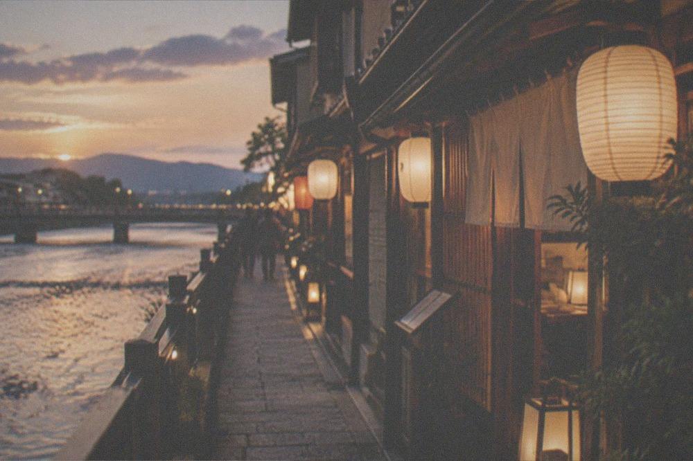
The west bank between Sanjo and Shijo holds Pontocho, one of the city's most atmospheric dining alleys, and the streets just off the river carry everything from standing noodle counters to kaiseki rooms; the east bank leads into Gion's teahouse culture and the Nishiki Market is a short walk inland from the Shijo bridge. Budget from a few hundred yen for street snacks to well above 30,000 yen at the top of the formal kaiseki scale.
That top figure needs honest framing. At Hyotei, the famous kaiseki house by Nanzen-ji, the restaurant's own front page prints kaiseki from 31,625 yen at lunch and 37,950 yen at dinner, tax and service included, while the same house's annex serves a morning rice porridge at 5,445 yen and a bento at 7,260 yen. Those are Hyotei's prices for those rooms, not a Kyoto average, but they show how wide the city's dining range runs and why "what does dinner cost" has no single answer. The site's kaiseki and dinner-cost pages carry the fuller breakdown.
For eating on the river itself, the summer custom is to buy from the shops near Shijo or Sanjo and sit on the bank steps, which costs whatever the food costs. The Nishiki market is ten minutes' walk from the Shijo bridge, and its association site is clear that shops keep their own hours, roughly 9 or 10:00 to 17 or 18:00, with no unified market opening time; it also discourages eating while walking, asking visitors to eat at the stall. The site's street food guide covers the rest.
What About The Kamo River With Kids Or In Bad Weather?
With kids, the delta, the stepping stones and the flat riverside cycle path are among the easiest free activities in the city, with the Iwatayama Monkey Park across town as the classic paid add-on; in bad weather, the river walk is genuinely unpleasant and the indoor options, the Railway Museum, the Manga Museum and the aquarium, are all a short transit ride from the river's line.
The child-friendly logic of the river is simple: it is flat, free, open and endlessly diverting, with ducks to feed, stones to count and gravel to throw at nothing in particular. The stepping stones demand a held hand for small children, and the bank edges demand the usual supervision near water, but there is no gate, no ticket and no queue.
The monkey park, in the Arashiyama district on the river's western counterpart, charges 800 yen for visitors 16 and over and 400 for ages 4 to 15, cash only, and its own site notes it closes early in bad weather or when the monkeys retreat up the hill, so it pairs badly with an uncertain forecast. The Railway Museum charges 1,500 yen for adults and 1,300 for university and high school students, with children from age 3 at 200 yen, and closes on Wednesdays and over the year-end.
Rain on the Kamo is a different question. The JMA normals put July at 223.6 mm and August at 153.8 mm, and the wettest day on record for the station dumped 288.6 mm in a single 24 hours in August 1959. After that kind of rain the stepping stones are underwater and the paths are muddy, and the right answer is to move indoors and come back. The site's rainy day and rainy season pages plan for exactly this.
What Nearby Day Trips Start From The Kamo River Area?
The Demachiyanagi end of the river is the departure point for the Eizan line into the Kurama and Kibune hills, one of the best half-day hikes out of the city, and the Keihan line from the same station runs south to Fushimi and its sake district; the JR and Kintetsu connections to Nara leave from Kyoto Station at the river's southern end of the transit web.
The Eizan line from Demachiyanagi is the one worth planning around. It climbs into the hills north-east of the city toward Kurama and Kibune, and the site's Kurama and Kibune guide covers the hike between the two villages. The Keihan line, which shares the Demachiyanagi station, runs the length of the eastern city and down to the Fushimi sake district, where the 3-hour insider sake brewery tour with tastings and pairings operates, and where the brewing houses sit along the canal that the river system feeds.
For river-themed trips further afield, the Hozugawa river boat runs a roughly two-hour descent through the mountain gorge above Arashiyama, at 6,000 yen for adults and 4,500 yen for children from infant to elementary age, on the operator's regular timetable from 10 March to 13 December. It is a different order of river experience from the Kamo's flat city reach, and it pairs naturally with the Arashiyama bamboo grove and the Sagano Romantic Train, whose standard one-way fare is 880 yen for adults and 440 for children.
Common Questions About The Kamo River In Kyoto
Where Are The Kamo River Stepping Stones At The Demachiyanagi Delta?
At the Demachiyanagi delta in northern Kyoto, where the Takano River joins the Kamo, directly below Demachiyanagi Station on the Keihan and Eizan lines. The crossing is free, has no posted hours, and goes underwater after heavy rain.
Can you walk the whole Kamo River through Kyoto?
Yes, the bank path is continuous from the delta through the downtown bridges and on south past the railway museum area, roughly four kilometres of level paved walking through the centre. Allow 45 minutes without stops, or half a day with the shrines and districts attached to it.
Are the Demachiyanagi stepping stones safe to cross?
In normal conditions, yes, with basic care: the stones are fixed, spaced for adult strides and slick when wet. Never attempt the crossing when any stone is submerged or the current is visibly moving across the line, and use the nearest road bridge instead.
What is the best month to visit the Kamo River?
Late March to early April for the cherry bloom, with the 2026 full bloom recorded on 30 March, or October to November for comfortable temperatures and the autumn colour building toward the maple normal of 5 December. July is the wettest month of the Kyoto year, 223.6 mm on the 1991-2020 normals, ahead of June.
Is the Kamo River free?
Completely. The banks, the paths, the delta and the stepping stones are public ground with no admission and no closing time, which makes the river one of the largest free attractions in a city of paid temple gates.
How do I get to the Demachiyanagi delta from Kyoto Station?
Take the Karasuma subway line north and transfer to a bus or the Keihan line for Demachiyanagi, or ride the Keihan line directly if starting from Gion-Shijo downtown. The flat bus fare is 230 yen, the subway 220 to 360 yen by zone, and the Subway and Bus One-Day Pass at 1,100 yen covers both.
The Kamo River asks nothing of you, which is the point of it. Cross the stones at the delta in the morning, follow the water south through whatever the day offers, and the city arranges itself along the bank: shrines, palace grounds, dining alleys, festival routes and the bonfire mountains above it all in August. Start at Kyoto Travel Guide's things to do in Kyoto overview if you are building a longer stay around it, and give the river at least one early morning before the downtown bridges fill up.